If we start by looking at Fearrington from about 30,000 feet

We can overlay the Geological Map of the Farrington (no e) 7.5 minute Quadrangle and get an excellent match

The map says most of these rocks (except the Triassic Basin) are metamorphic. Wikipedia says
- Metamorphic rocks arise from the transformation of existing rock types, in a process called metamorphism, which means "change in form". The original rock (protolith) is subjected to heat and pressure, (temperatures greater than 150 to 200 °C and pressures of 1500 bars[1]) causing profound physical and/or chemical change. The protolith may be sedimentary rock, igneous rock or another older metamorphic rock.
- Metamorphic rocks make up a large part of the Earth's crust and are classified by texture and by chemical and mineral assemblage (metamorphic facies). They may be formed simply by being deep beneath the Earth's surface, subjected to high temperatures and the great pressure of the rock layers above it. They can form from tectonic processes such as continental collisions, which cause horizontal pressure, friction and distortion. They are also formed when rock is heated up by the intrusion of hot molten rock called magma from the Earth's interior. The study of metamorphic rocks (now exposed at the Earth's surface following erosion and uplift) provides information about the temperatures and pressures that occur at great depths within the Earth's crust. Some examples of metamorphic rocks are gneiss, slate, marble, schist, and quartzite.
Things are complicated, which probably explains why Fearrington is such a varied landscape
- Zefg-m Most of Fearrington Village is on the East Farrington Pluton - Granite
- Zabit The Knolls and Bush Creek neighborhoods hang down into an area of volcanic intrusions
- Zwfd Coming in from the west is the bright pink West Farrington Diorite; similar to granite
- Trc/si1 Trending in from the Northeast is the light green of the Chatham Group Lithofascies Association, composed of sedimentary sandstones and mudstones. This is the western edge of the Deep River Triassic Basin, which could be exploited for natural gas by "fracking"
- Qal Along Bush Creek are smaller deposits of alluvial soils
We have our own fault. Those annoying visitors from California have nothing on us! The Bush Creek Fault which is "extinct" comes into our area at the start of Big Woods Road, off of Jack Bennett. It follows straight along Bush Creek, crossing Millcroft about at Langdon. Then on to Mt. Gilead Road before petering out in Bynum. The westerly view along the fault from the causeway at the start of Big Woods Road is quite wonderful, possibly even Triassic. It has been proposed as the home of Carolina Dinosaur Rescue, for Brontosaurii that outgrow their homes.

The dark solid line on the geology map, going from upper left to lower right is the location of this cross-section:

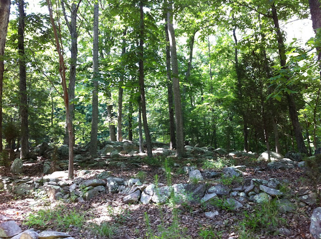
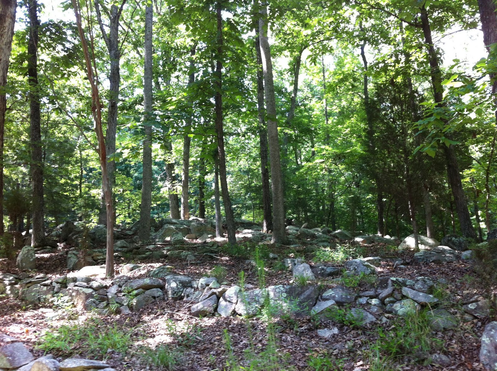
It shows the intrusion of the diorite along the fault, and the close proximity of the Deep River Basin. The red lines are dikes - intrusions along fissures. The collections of boulders scattered around the area are weathered dikes. Homesick Vermonters may think this yard on Wintersage looks familiar, but no glacier ever came within 750 miles:
Melinda Meade, resident polymath adds: If you go up on the road to the current stump dump (off Woodham at Millcroft), beyond the gate and around the curve, but not far on the right, Fitch has cut into a cliff face for decades to get clay and dirt and rocks for fill. At the bottom of the cliff and in scattered rocks around is the gray triassic mudstone. It's soft enough to break with your hands, and I've done just a few pieces and found fossil leaves in it.
Further reading:
Shale Gas
Carolina Geological Society
Comments? Additions? Errors? wcreed@gmail.com

The dark solid line on the geology map, going from upper left to lower right is the location of this cross-section:
It shows the intrusion of the diorite along the fault, and the close proximity of the Deep River Basin. The red lines are dikes - intrusions along fissures. The collections of boulders scattered around the area are weathered dikes. Homesick Vermonters may think this yard on Wintersage looks familiar, but no glacier ever came within 750 miles:
Melinda Meade, resident polymath adds: If you go up on the road to the current stump dump (off Woodham at Millcroft), beyond the gate and around the curve, but not far on the right, Fitch has cut into a cliff face for decades to get clay and dirt and rocks for fill. At the bottom of the cliff and in scattered rocks around is the gray triassic mudstone. It's soft enough to break with your hands, and I've done just a few pieces and found fossil leaves in it.
Further reading:
Shale Gas
Carolina Geological Society
Comments? Additions? Errors? wcreed@gmail.com